
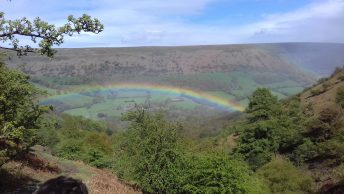

The UK has fantastic countryside in terms of hiking opportunities, whether you’re tackling remote peaks in the Scottish highlands or enjoying the South Downs Way. But just how different those two places are brings its own challenges when it comes to weather forecasts for hiking – standard forecasts like Apple or Google Weather just don’t provide the information or accuracy that’s needed. In this post, I’ll explore the best weather forecasts for hiking in the UK and how to use them to plan your days.
Jump to…
Why check the weather? I can handle some rain…
Checking the forecast isn’t primarily about whether you mind getting a bit soggy on your hike – it’s about safety. Knowing what to expect from the weather will help you know what kind of equipment you’re likely to need. For example, it might be beautiful and clear weather in the valley, but if it’s snowing on the summits and has been constantly cold for a while, you’ll need to take lots of extra layers. You might even consider if your boots are suitable for snow and ice or whether or not you’ll need crampons.
The level of wind should also influence the kind of route you plan: on a strongly breezy day I’d stay away from exposed areas and steep drops, because the wind can knock you off balance – so you need to avoid places where a slip or fall would have heavy consequences.
What’s wrong with standard forecasts?
The short answer is nothing – standard forecast providers like BBC Weather or the Met Office are great. But they usually don’t provide the depth of information you need in the hills. When you’re hiking in the mountains, you’re often far from settlements where standard weather stations are located. Elevation and local topography have very significant effects on weather, and standard forecasts don’t take this into account.
Specific Weather Forecasts for Hiking
There are a couple of weather forecasts for hiking that I really like for UK forecasting: MWIS and the Met Office Mountain Forecast. They have slightly different use cases, which I’ll explore below.
The Mountain Weather Information Service (MWIS)
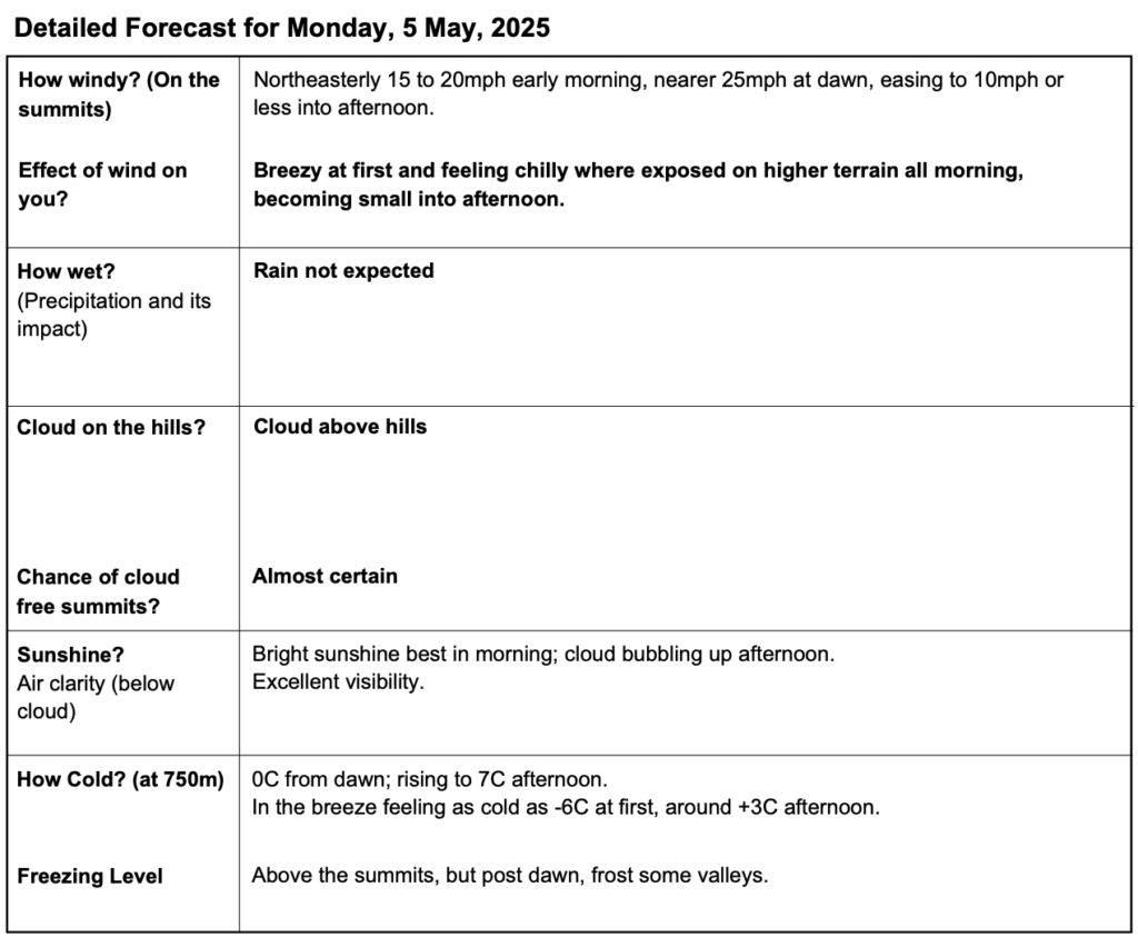
One of the most reliable sources for mountain weather forecasts in the UK is the Mountain Weather Information Service (MWIS). MWIS provides detailed regional forecasts specifically tailored for the mountainous regions of Scotland, and has recently expanded to national parks in England and Wales.
Key Features of MWIS:
- Regional Forecasts: MWIS doesn’t provide granular forecasts (e.g. per village, valley or hilltop). Its forecasts are available for UK national parks, and most mountainous areas of Scotland. This makes it really useful as an overview to plan your day: you can find all the information you need, in one place.
- Downloadable: MWIS forecasts are presented as A4 PDFs, so they’re really easy to download or print for offline reference.
- Detailed Information: The forecasts include information on wind speed, temperature, precipitation, and cloud cover, all of which are vital for mountain safety.
- Daily Updates: MWIS updates its forecasts daily, so there’s no need to check back every few minutes.
Find the MWIS at mwis.org.uk.
Met Office Mountain Forecast
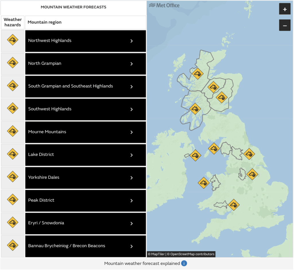
As well as their usual forecast, the Met Office also offers a dedicated Mountain Forecast service, which is particularly useful for hikers and climbers. This service provides forecasts for specific mountain areas, focusing on conditions that are relevant to outdoor activities.
Key Features of Met Office Mountain Forecast:
- Overview Forecasts: Like the MWIS, the Mountain Forecast also provides overview forecasts for upland regions of the UK.
- Specific Points: In addition to the general forecasts, they also have peak-specific forecasts. You can view these from the regular Met Office app, which is useful.
- Altitude-Specific Data: The forecasts take altitude into account, providing a more accurate picture of what to expect at higher elevations.
- Weather Warnings: The Met Office issues weather warnings that can help you avoid dangerous conditions, such as high winds or heavy snowfall.
- Interactive Maps: The Met Office website features interactive maps that allow you to visualize weather patterns across different regions.
Find the Mountain Forecast here.
Other Useful Resources
In addition to MWIS and the Met Office Mountain Forecast, there’ are several other resources that can enhance your hiking experience:’s one other tool I regularly use to plan my days: the Scottish Avalanche Information Service. Obviously, this is only useful if you’re a) in Scotland and b) in avalanche season. They also have a useful app (BAA – Be Avalanche Aware) for iOS and android, which is worth having. This isn’t an avalanche awareness tutorial, so I won’t cover avalanche risk planning – but it’s good to be aware of the service!
How to Use Weather Forecasts to Plan Your Route
Finally, I’ll return to this topic for a moment. It’s really important to know how to modulate your plan for the weather, so a few more words won’t hurt.
1. Check Multiple Sources
Before heading out, I always check forecasts from both MWIS and the Met Office (and any other relevant sources – e.g. talking to locals about what to expect). Cross-referencing information gives me a clearer picture of what to expect, so I can change my route to match specific conditions.
2. Consider the Time of Day
In the mountains, weather conditions can change rapidly. Plan your hike to take advantage of the best weather: conditions are typically more stable in the morning, for example. The aspect of your route (which face of a mountain you’re on) is also important: with careful planning, you can keep yourself in (or out, depending on specific conditions) of the sun all day, as it and you both move.
3. Be Prepared for Change
Always be ready for sudden weather changes. Forecasts can give you indications of what these might be, but they’re not always foolproof. Carry appropriate gear, including waterproof clothing and extra layers, and have a backup plan in case conditions worsen.
4. Stay Informed While Hiking
If you have mobile service in the area, consider checking weather updates while out. This can help you make informed decisions about continuing your hike or turning back, and is particularly important on days with changeable or bad weather.
Conclusion
Planning a hiking trip in the UK requires careful consideration of the weather, especially in mountainous regions where conditions can change rapidly. By using specialised weather forecasts for hiking, like the MWIS and the Met Office Mountain Forecast, along with other resources, you can ensure a safer and more enjoyable hiking experience. Remember, the mountains are beautiful but can be unpredictable, so always prioritise safety and stay informed.
Now that you’ve mastered the weather forecasting, check out our guide on actually planning a route. Or, if you’re new to the Great Outdoors, we’ve got a great guide on navigating in the hills. Finally, if you’re planning a multi-day adventure, we’ve got some tips on what to pack!